




Google Maps has updated its label for Lake Ontario to “Lake America” for users within the United States. This change follows an executive order issued late last week.
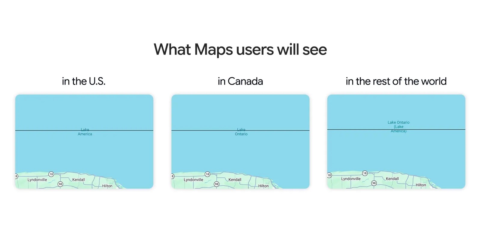
The popular navigation service implemented the renaming specifically for its US audience. This alteration reflects a governmental directive impacting how the platform displays geographical names, marking a notable change for millions of users relying on the service daily.
Users accessing Google Maps from outside the United States will continue to see the traditional “Lake Ontario” designation. Google has not publicly detailed the specific text of the executive order that prompted this renaming.
Lake Ontario is one of North America’s five Great Lakes, forming part of the border between the United States and Canada. Its renaming on Google Maps for US users highlights the platform’s immediate responsiveness to national directives and its impact on digital cartography.
Google Maps, a ubiquitous web mapping service, provides extensive global geographical data. It offers features such as satellite imagery, street views, real-time traffic, and comprehensive route planning for various modes of transport. The service regularly updates its information to reflect current conditions, new infrastructure, and official mandates from governments worldwide. Further insights into Google’s broader initiatives and product updates are often shared on the Google Official Blog.
Such geographical name changes in widely used digital mapping services are uncommon but underscore their role in reflecting official nomenclature. The localized rollout ensures the change is visible only to the specified user base within the United States, maintaining international consistency for other regions. Official executive orders and presidential actions can typically be found on government websites, suchs as the White House Executive Orders page.